


ROMA Voting District, Maricopa County, Arizona
About
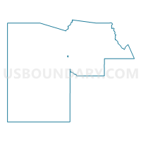
Outline

Summary
| Unique Area Identifier | 524752 |
| Name | ROMA Voting District |
| County | Maricopa County |
| State | Arizona |
| Area (square miles) | 0.62 |
| Land Area (square miles) | 0.62 |
| Water Area (square miles) | 0.00 |
| % of Land Area | 100.00 |
| % of Water Area | 0.00 |
| Latitude of the Internal Point | 33.49967370 |
| Longtitude of the Internal Point | -112.24185950 |
Maps


Graphs
Select a template below for downloading or customizing gragh for ROMA Voting District, Maricopa County, Arizona


Neighbors
Neighoring Voting District (by Name) Neighboring Voting District on the Map
- CARL Voting District, Maricopa County, AZ
- COOLIDGE Voting District, Maricopa County, AZ
- CORA Voting District, Maricopa County, AZ
- GLENDALE 17 Voting District, Maricopa County, AZ
- GLENDALE 25 Voting District, Maricopa County, AZ
- SELLS Voting District, Maricopa County, AZ
- STARLIGHT Voting District, Maricopa County, AZ
- WELDON Voting District, Maricopa County, AZ
- WESTWIND Voting District, Maricopa County, AZ
Top 10 Neighboring County Subdivision (by Population) Neighboring County Subdivision on the Map
Top 10 Neighboring Place (by Population) Neighboring Place on the Map
Top 10 Neighboring Elementary School District (by Population) Neighboring Elementary School District on the Map
- Cartwright Elementary District, AZ (112,047)
- Glendale Elementary District, AZ (97,573)
- Pendergast Elementary District, AZ (66,972)
Top 10 Neighboring Secondary School District (by Population) Neighboring Secondary School District on the Map
- Phoenix Union High School District, AZ (652,590)
- Glendale Union High School District, AZ (323,335)
- Tolleson Union High School District, AZ (164,860)
Top 10 Neighboring State Legislative District Lower Chamber (by Population) Neighboring State Legislative District Lower Chamber on the Map
Top 10 Neighboring State Legislative District Upper Chamber (by Population) Neighboring State Legislative District Upper Chamber on the Map
Top 10 Neighboring 111th Congressional District (by Population) Neighboring 111th Congressional District on the Map
- Congressional District 2, AZ (972,839)
- Congressional District 7, AZ (855,769)
- Congressional District 4, AZ (698,314)
Top 10 Neighboring Census Tract (by Population) Neighboring Census Tract on the Map
- Census Tract 820.08, Maricopa County, AZ (5,058)
- Census Tract 1097.02, Maricopa County, AZ (5,053)
- Census Tract 927.13, Maricopa County, AZ (5,027)
- Census Tract 1096.01, Maricopa County, AZ (4,723)
- Census Tract 820.09, Maricopa County, AZ (4,668)
- Census Tract 927.20, Maricopa County, AZ (4,407)
- Census Tract 820.07, Maricopa County, AZ (4,077)
- Census Tract 820.10, Maricopa County, AZ (3,931)